|
Most people will start fishing on piers where there is plenty of water and not much in the
way of visible features at full tide.They may have followed advice on which piers may be best,but there will come a time when
they realise that there are plenty more,and often better,places to go fishing.So in this section we will have a look at what
to look out for when you are trying to find new marks to fish.
Firstly,you have to think of the approximate area that you think might be suitable,then the
best thing to do is to go there at low tide,the lower the better,and have a look around,take some mental notes,take some written
notes or sketches and take some photos of the area. Try to stand where you think might be your fishing point and look on the
horizon for identifying features that you can line up your intended casting point with. Fishing the East Neuk,you have the
advantage of the opposite side of the Firth of Forth with plenty of lighthouses,islands,hills,pylons,etc to use for this purpose.
This is how I'd do a sketch for this purpose. Nothing is to scale,nothing is pretty,but it
contains the usefull information that I'd see at low water for using when the tide has flooded and I can now only see featureless
water.
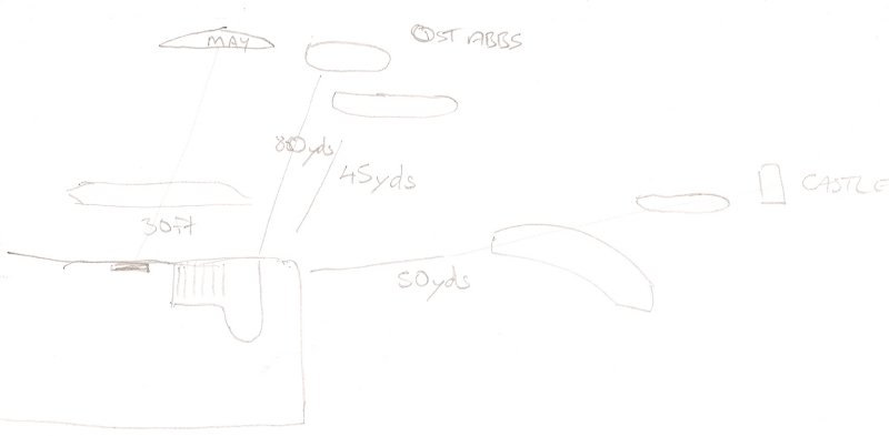
Although this sketch may look a mess,I can now tell that if I stand at the bottom of the steps
beside the lifebelt,there is a clear patch at only about 30 feet out,and I should cast that distance in the direction of the
May Island on the horizon.If I then come to the end of the pier,There is a good spot 80 yards distant if I aim my cast in
the middle of the May Island and St Abbs head.I can also drop one rod shorter at 45 yards aiming at St Abbs itself. Coming
off the point of the pier there are two good spots roughly in line with the ruined castle on the opposite side of the Forth,one
at 50 yards,a good big one that would take two cast easily,and a further out smaller one just behind it.
Now,as I've said this is by no means scientific,but armed with this wee bit info that took
me 5 minutes to note down,I'd bet my last quid that I'd have a better chance of a successful days fishing than someone who
hadn't bothered.
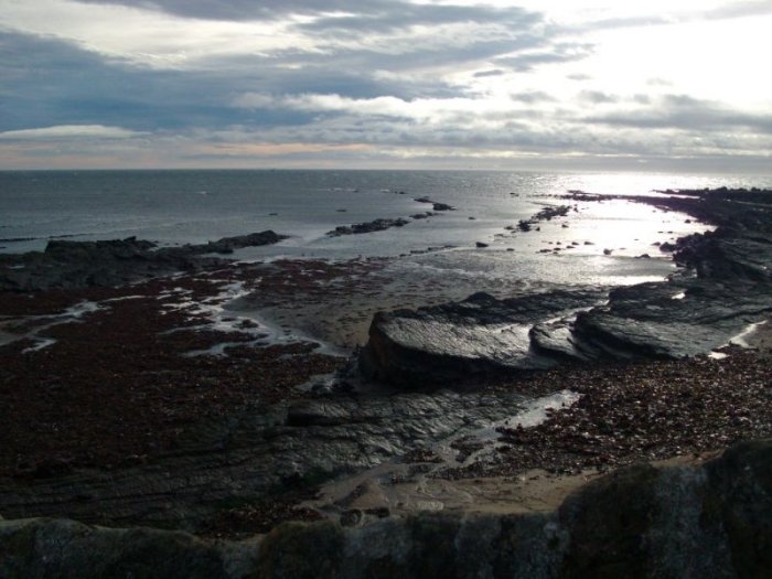
In summer time you would be looking to find rock marks that have plenty of kelp around,maybe
6 feet plus of water,and some clearer patches in the weed to help you land a cast and have a better chance of bringing your
gear back. These marks are best fished on calm evenings and mornings for red cod,but mid afternoon for wrasse.
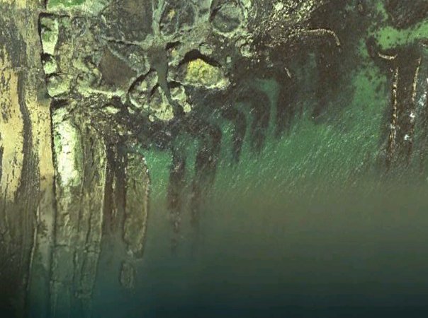
These days a good look at one of those Google Earth type websites can aid in choosing summer
marks as they are clear enough to help you spot areas which will have those wee clear spots that fish well. This is one of
the local marks show on one of these programs which shows you exactly where you can cast.
For instance. You're out for a walk along the shore,spot this area which looks promising.But,how
do you know where to cast to best advantage.
Have a look at it from the sky,that's how.
Winter marks are a bit different.Best weather to fish is easterly swells,and best time is
darkness. Those two facts automatically rule of a lot of the summer marks because they would be just too dangerous.
Cod have different habits in winter too,and will venture right up to the high water mark in
the search for food so you can target them from beaches,shoreline paths,high water skellies practically anywhere you have
2 or 3 feet even of water.
What I look for in winter marks is storm beaches,by that I mean steep beaches,these will flood
quickly and then steadily fill up over the length of the incoming tide,and rocky bays where fish are afforded a bit of shelter
from rough seas,yet plenty have the potential for feeding. Ideally a spot where there is a solid skelly that I can move back
with the tide without worrying if I'll be cut off,or a spot where I can access as the tide drops,yet I know will give me a
couple of hours before I need to vacate for the incoming tide.
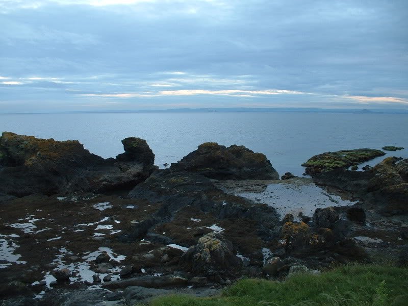
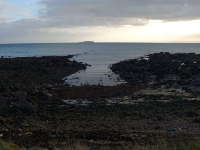
In this photo you see I have the bay which I can fish in from either the skelly to the right,or
from the beach itself.
In this bay I have rocks at both sides,the beach,and also a marker of the May Island lighthouse
at night to find the narrow channel entrance.
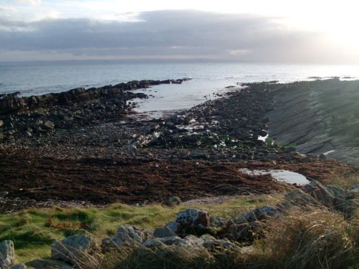
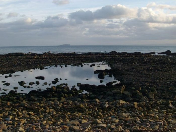
This spot is an open boulder field,but the fact that there is a deep puddle here at low water
will mean a good deep indentation at high water where fish will lie.Again I can use the May light as a bearing,and in the
second picture you can see that by the steepness of the beach here I can have shallow water early on in the flood,but I won't
have to retreat as the tide comes in as the beach is steep and the water will only come up it quite slowly.
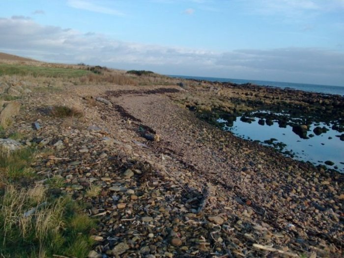
Finally,cod will also come onto clean sand quite happily in winter and finding spots where
there is a nice flat sandy area is also well worthwhile.
|