|
Cellardyke is actually joined on to Anstruther,and so firstly follow the coast road
to Anstruther.At the one and only roundabout,take the road leading down to Anstruther Harbour.Follow this road along past
the harbour,and about 100 yards past the East Pier,(the one with the small red lighthouse),you have the choice of either keeping
on the main road which veers 90 degrees to your left up a hill,or leaving the main road and heading straight on into
a street of houses.This is Cellardyke.
Now that you are in Cellardyke,this mark is slightly tricky to find the first time.Please
feel free to print out these directions if you like to help with this next bit.
Follow along this road about 300 yards and you'll see the Town Hall facing you.When
you're at the Town Hall,you can either go left up a hill,(don't),or right down to the beach,(don't),or carry straight on.Go
straight on,(there's a bit of a right/left chicane here),heading towards Cellardyke harbour.
You should have a Chinese Takeaway immediately to your right,and a pub about 50 yards
past the Town Hall to your left. keep going along this narrow road for about another 200 yards.Look for a small car park to
your left,and a small shop,(closed),to your right.Park here if there's space.
You now need to walk along the same road you've been driving,and keep looking to your
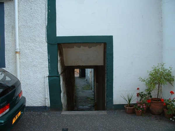
right.About 100 yards past the car park is a small,low close,or ginnel depending on your accent.
Close Leading Down To The Mark
This close leads to the wynd which will take you to the beach.It's a public path and
although it's right in amongst the houses you're okay to use it.
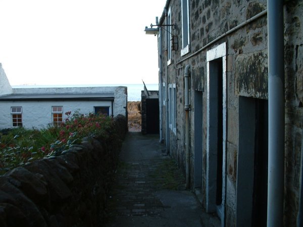
View From The Wynd.The Rock Showing At The End Is The Mark
View Of The Mark From The Close End
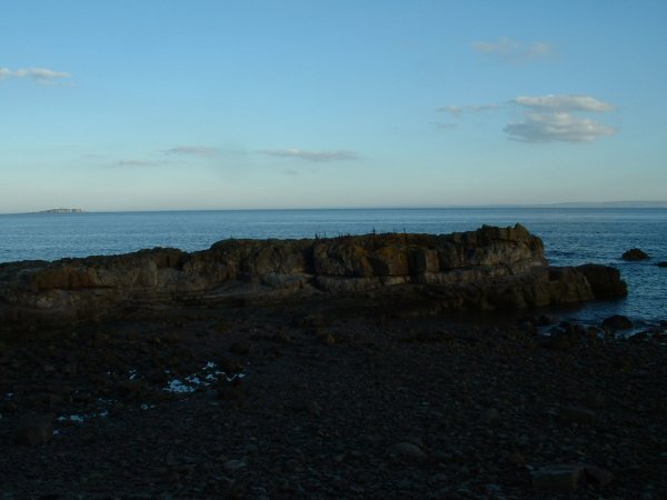
Once you are down on the beach,simply head up over the large rock facing you.How far
over you will get will depend on the tide,but this mark fishes well from very low water right up to full tide.Unless it's
a large tide,the water will not come right around this rock,so you simply fall back a bit as the water comes in.My personal
preference is to fish it at low water,as you can get further down and see the "lie of the land" better. 3 hours before low
water,to 3 after I'd recommend.
This is a really good mark for red cod and wrasse and don't be surprised to get in
the teens of fish apiece,and cod up to high single figures and wrasse up to 4 or 5lb. The downside is it really is rough ground,and
you've got to be prepared for it.Lots of kelp,lots or rocks,lots of snags. I'm sure that Sea Angler magazine did a feature
here about 6 or 7 years ago and had piles of cod.
As with most rock marks though in this area,it's a bit dodgy in rough seas,and a no-go
area at night. Not suitable for youngsters really either.Fishes best in early and mid summer,may through to september,but
likely to have fish of some sort all of the time.
If you look around you when you're down here you will also see other good rocks to
fish from,but beware if you have a go,as the tide will be a factor there for cutting you off.I've listed this rock specifically
as it's 'safe' in rock fishing terms,but some of the others in this area command a bit more respect.
|