|
How To Get There
Simply carry on another 400 yards or so from the Scoot Skelly mark,and you'll find
a sandstone outcrop on the face of the grassy shore.This is the Caiplie Coves,a series of caves of varying depths into the
hillside.Just past these caves is a flat rock formation which is the mark you're after.
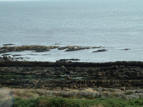
View Of Caiple Rocks Mark From The Top Of The Hill
This view of the mark is taken at half tide to show that it is possible to fish this
area from low water right up to full tide by simply coming back along the skelly as the water rises.The flat rock area extends
inshore right to the beach.
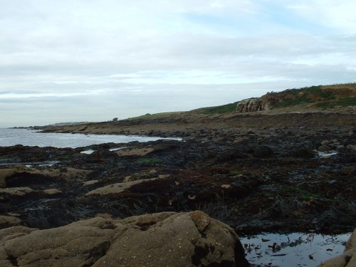
Caiplie Rocks Looking Back Towards Caves
Although likely to be less productive than the Scoot Skelly mark,the benefit here
is that you can fish it right back from low water without fear of being cut off,and it's much more rough water friendly,as
well as being more accessible on neap tides.This mark is probably nearer Crail than Cellardyke and so can be reached by taking
the coastal walk from the Crail end if you prefer.
Catches should be cod and wrasse right through the year,with larger cod in the winter
months.
|